

The Columbia River Gorge is chock full of hikes at various skill levels, and one of the harder ascents I’ve just added under my belt is on Washington’s south side of the Bridge of the Gods. Seven miles from the bridge is the more famous Beacon Rock – a towering boulder with striking views of the Gorge (and a portion of the distance you will usually have to hike to get the same views). Directly across from the Beacon parking lot is a sign for campgrounds and access to Hamilton Mountain. Luckily this hike could easily be split into three lengths and difficulty levels: 3.2 miles (medium), 6 miles (difficult), 9 miles (more difficult). Having done the whole thing, I might opt for the 6 miler next time, but it’s still worth all the work.
Distance: 3.2, 6 or 9 miles
Elevation Gain: 2,100 feet
Time: 5 hours (perhaps longer if you stop for lunch, which you should)
Difficulty: Medium, Difficult or More Difficult
Season:Spring, Summer, Fall
How to Get There: From Portland, take I-84E to the Cascade Locks exit. Turn right toward the Bridge of the Gods, pay the $1 toll, and after crossing the bridge turn left onto Hwy 14. You’ll see the parking lot for Beacon Rock on the left hand side, and on the right is a sign for camp grounds. Turn right at the camp grounds sign, and make your way up to the Hamilton Mountain parking lot. You’ll need a Discovery Pass ($35 for the year or $10 for the day) and can pay at the trailhead.
Trail Condition: Very well kept, and maneuverable when raining, though I would I would not recommend going all the way up to Hamilton Mountain if the ground is wet and muddy.
The Trek
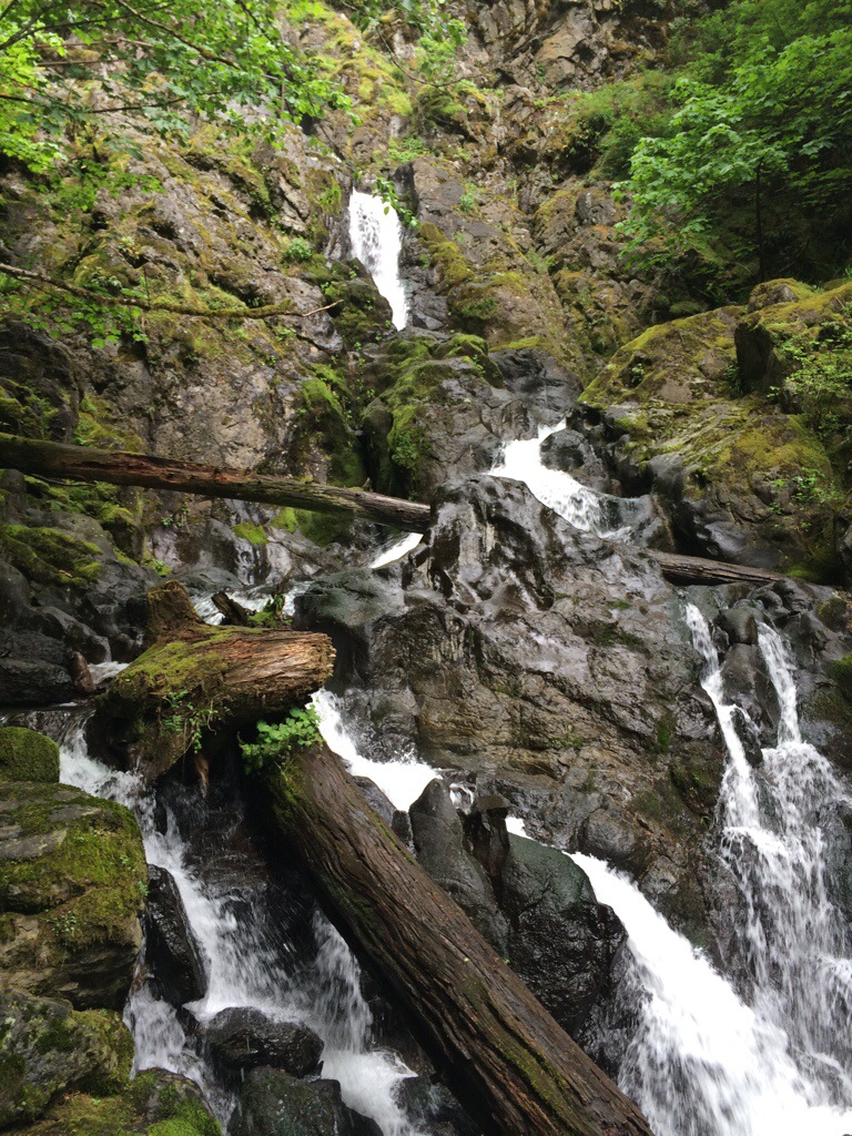
The trail wastes no time jumping into a medium grade ascent, and keeps going for a solid 3/4 mile before leveling out and having a more gradual incline. During the start of the hike, you’ll be well shaded in the forest, but still have beautiful woodsy views until you hit a bit treat: Hardy Falls at 3 miles. I saved the waterfall viewing until after the heavy trek was done, but it’s a gorgeous shot no matter when you stop to enjoy it.
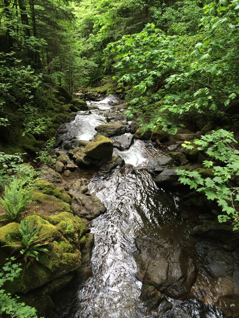
Cross over the bridge and keep climbing for another 2 miles where you’ll reach the first optional stopping point. If you’ve ever hiked Angel’s Rest, it’s a similar feeling with expansive views on top of a massive cliff. It’s a prime picnicking spot if no one else is around and you feel you’re tapped out of the extra climb, but if you’re looking for more, continue on to the top.
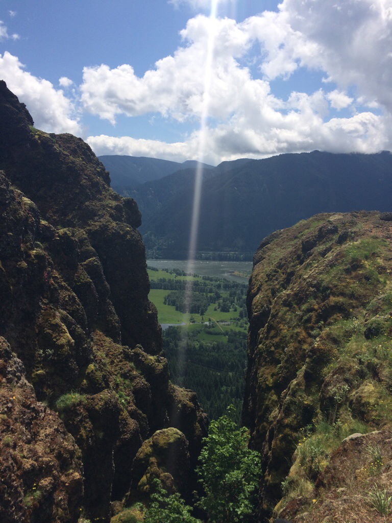
Shortly after the outlook bend, you’ll come across a narrower path and an impressive view of Hamilton Mountain above, and to your right is a sneaky path to give a unique view of the Gorge.
A word of caution: climb at your own risk! This outlook is extremely steep and NOT part of the trail, so do not have more than 2 people up there at a time, and if you’re weary of heights, let your daredevil friends bring you back a snapshot.
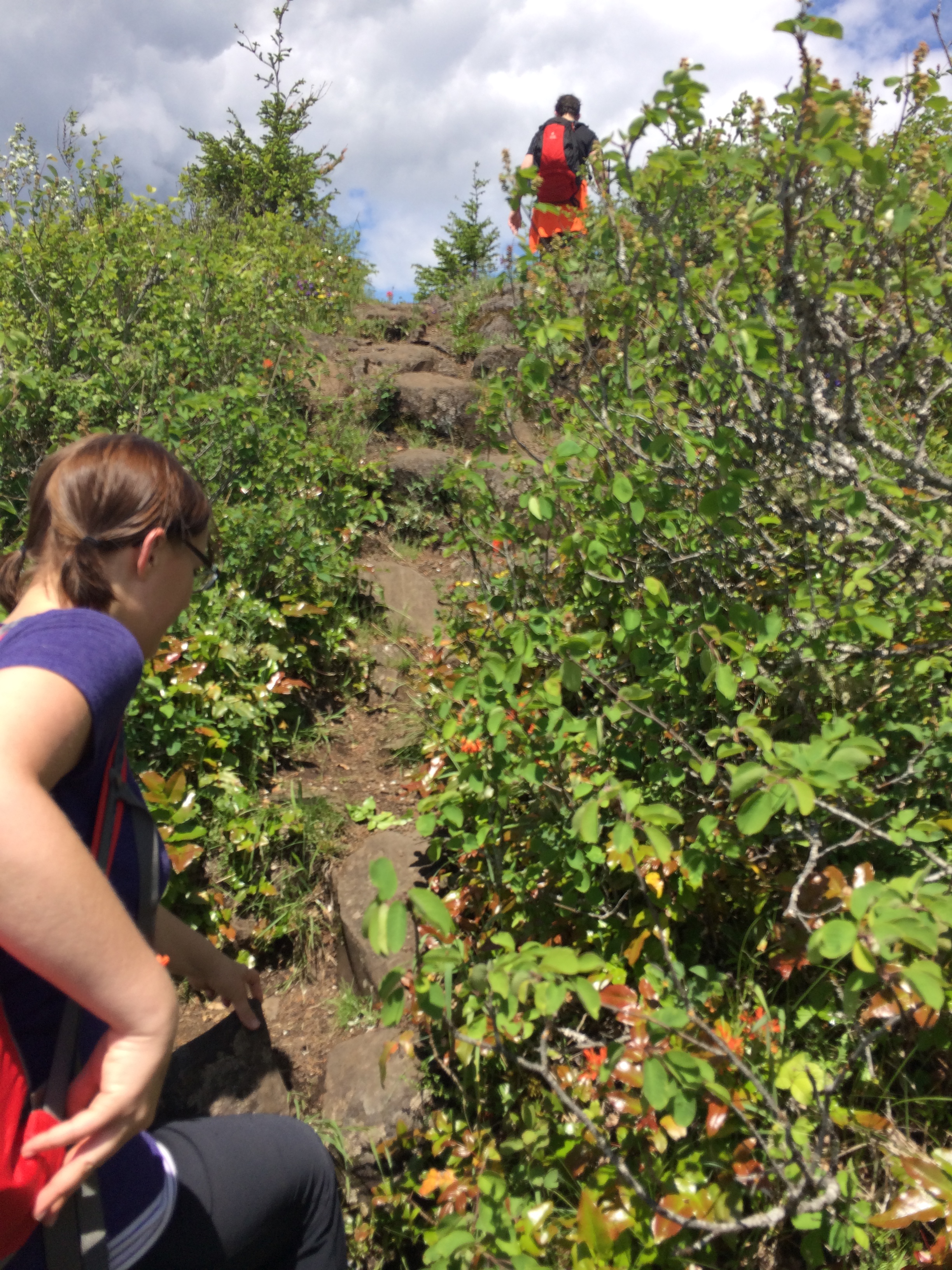
 Continuing on from this viewpoint is where the going gets pretty steep again. There’s a cross roads to take the “difficult” route to your left or the “more difficult” route to your right. I recommend ascending on the more difficult path and rounding back on the difficult one, otherwise your knees may have some unkind words for you. The balance of the route is covered with seasonal flowers and vegetation – a beautiful visual interlude during the hefty climb.


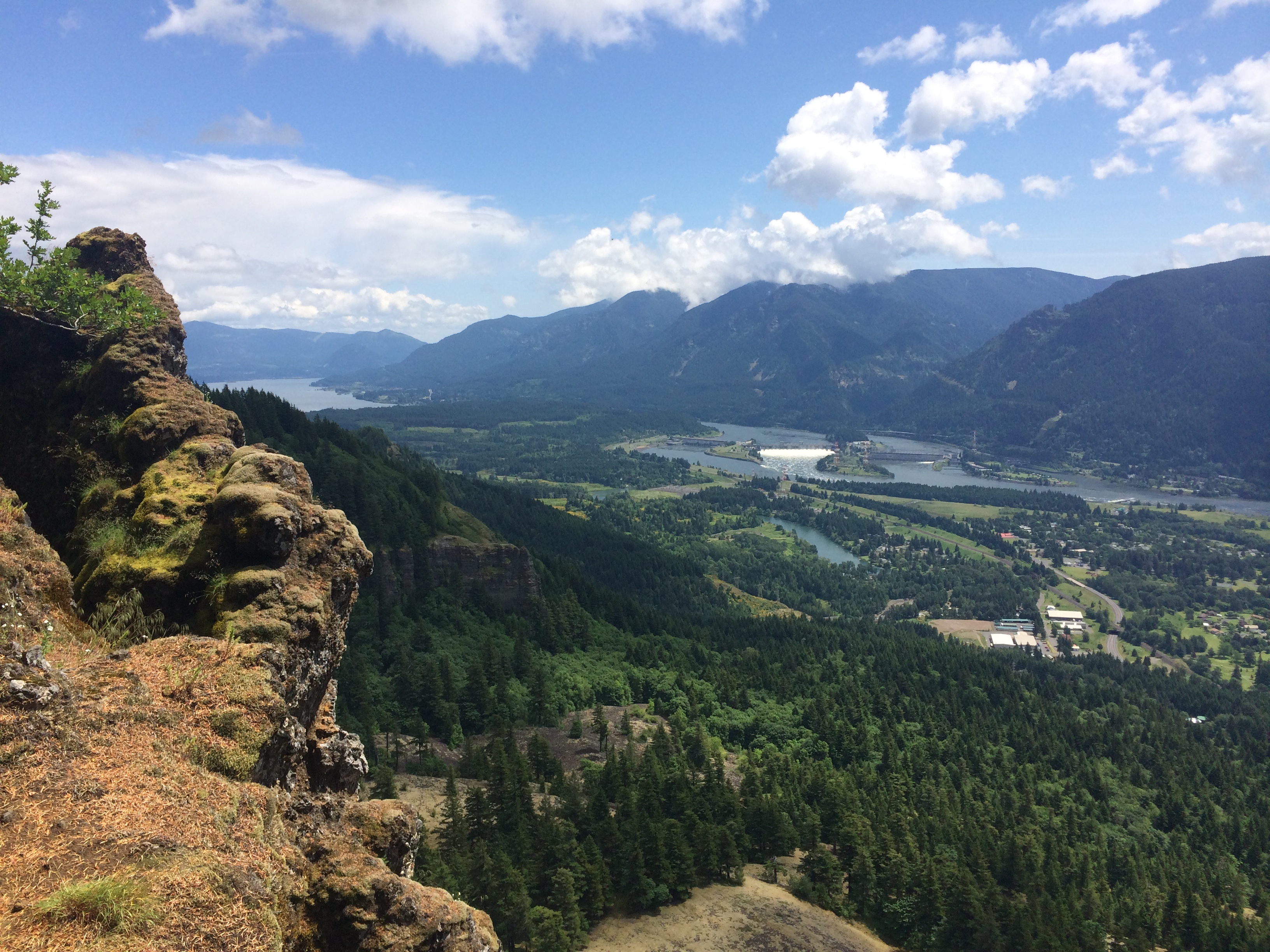
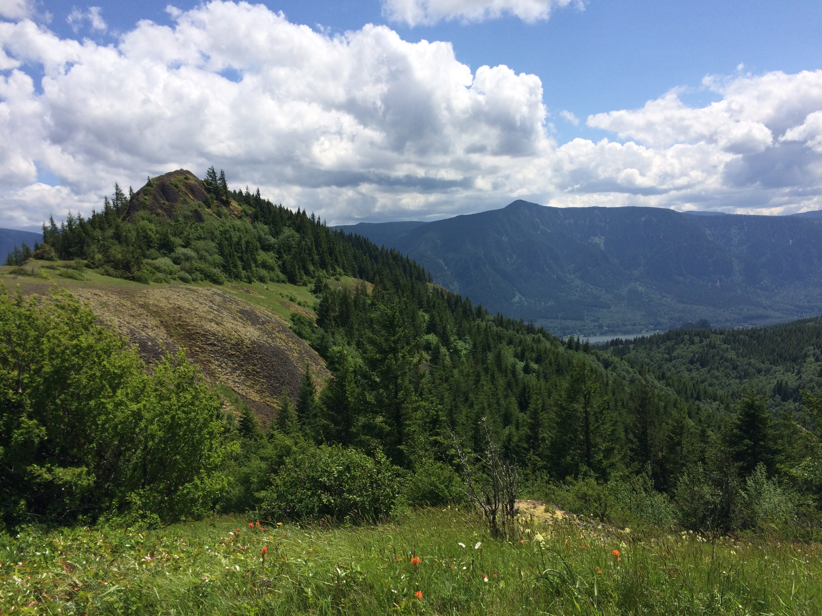
At the very top, you can follow the path around to the right for an outlook of Table Mountain, Bonneville Dam and the Gorge, but I’d say continue on the path to the left for about a quarter mile, maybe less. The top two options for a lunch spot include an overlook just above the path to the right, or continue the full quarter mile to a wide spread outlook.
This “non-path” leads up to a small overlook with beautiful views of Table Mountain and the Gorge (and is uninterrupted by passersby).
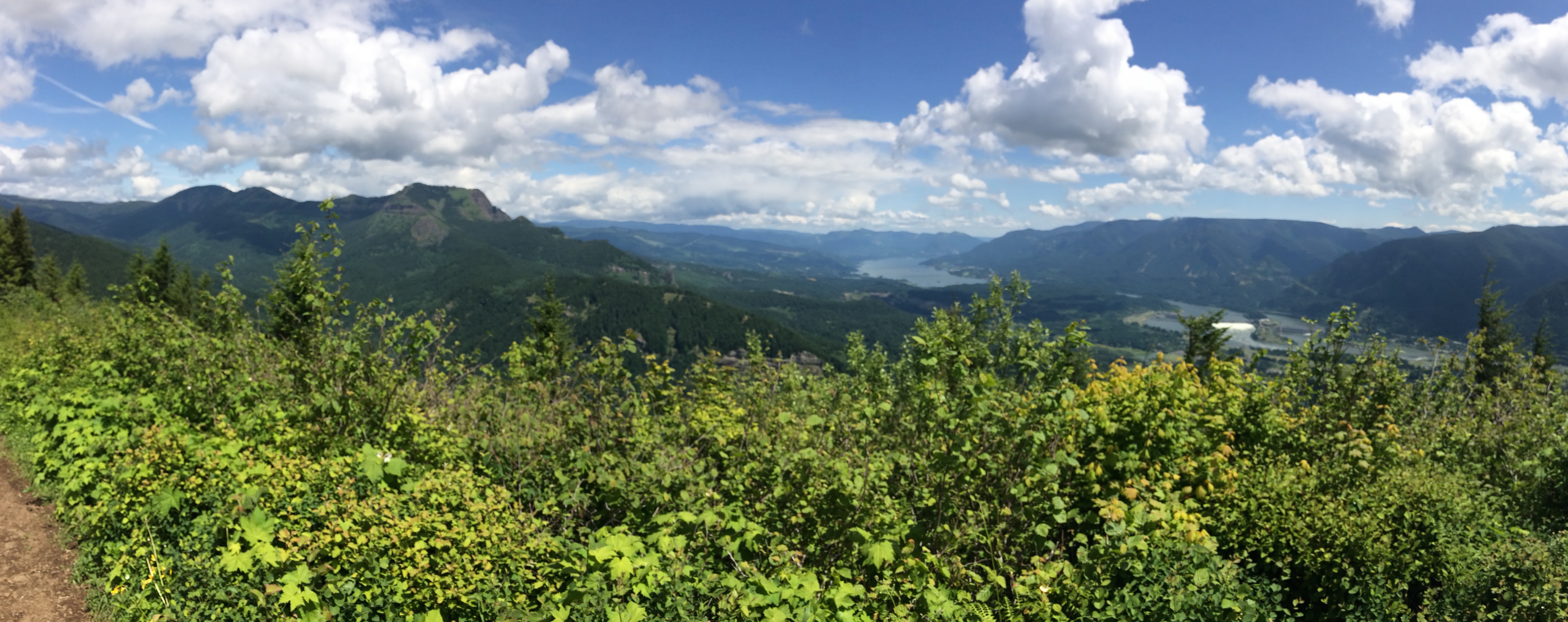
Panoramic view from the top of Hamilton Mountain with a clear shot of Table Mountain and Bonneville Dam.
Once you’ve reached this spot, it’s all downhill to the trailhead.
Rodney Falls, Hardy Falls and Pool of the Winds are a breathtaking finish to the hike. You will have already seen the falls on the trek in, but make sure to head up to the Pool of the Winds viewpoint to experience the Falls’ intensity. Unfortunately, I still cannot figure out how to get closer to Hardy Falls other than the two outposts provided. If anyone has suggestions, I’m all ears!


One thought on “Trekking to Hardy Falls and Hamilton Mountain”