

For the average carless girl (moi), there are limited easy access hiking options, but thankfully Portland is a city full of possibilities and alternative transportation. From bike friendly streets to car sharing services, I know that my lack of car ownership will not get in the way of a good hike. My friend and I decided to take a break from the Gorge and take advantage of the local urban trails. Our destination: the Marquam Trail.
The Marquam Trail covers just shy of 6 miles and nearly 1,100 feet of elevation gain to an incredible lookout over downtown Portland. If you’re new to Portland (or looking for a slightly longer adventure), you can extend your trip to do the entire 4T Trail hike, which includes all, *ahem* four T’s: trail, train, trolley and tram. For this trip, however, my friend and I decided to only do the trail “T”. We accidentally started a little earlier than Marquam Trail Trailhead, and walked up Terwilliger Boulevard, which gave us a great view of downtown and near perfect placement of the tram descending from OHSU.
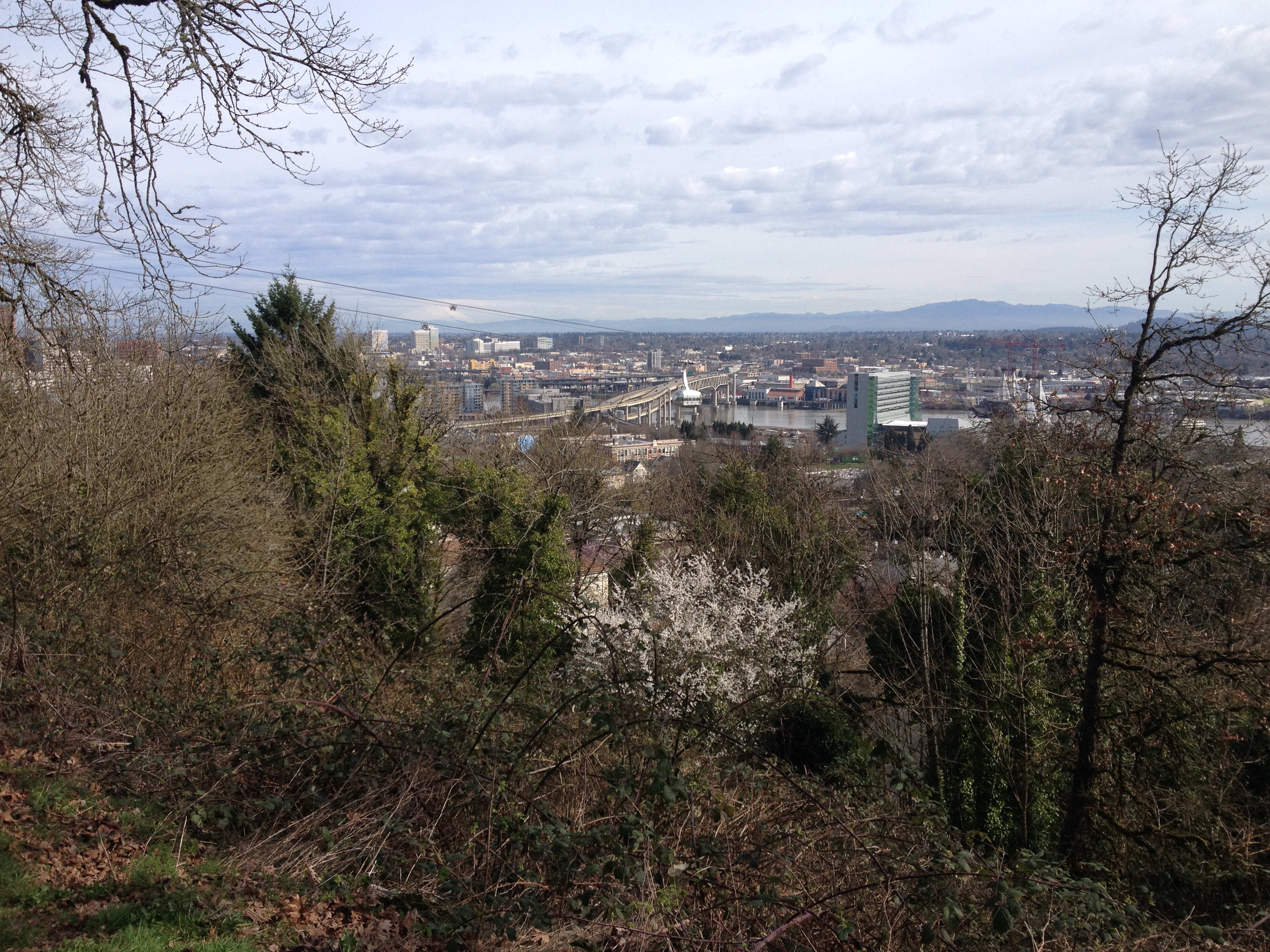
From Terwilliger Boulevard, there’s a great vista of downtown Portland, Mt. Hood peaking through the clouds and the occasional tram sailing through.
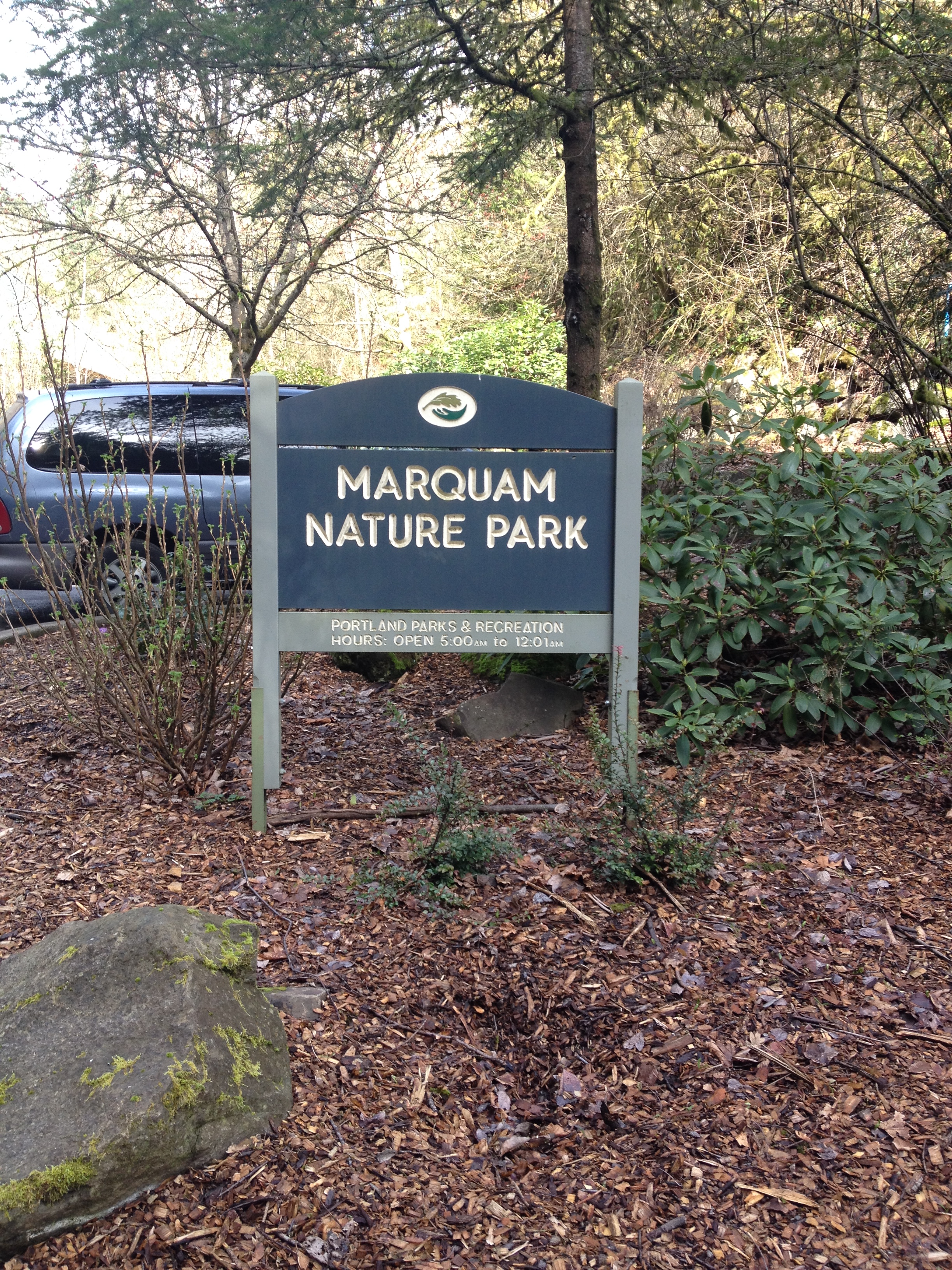
The actual way to the trailhead is to drive up SW Sam Jackson Road, go past Terwilliger Boulevard, and you will see the trailhead just to the right before the road bends. If the parking lot is full, there is some ad hoc overflow parting available closer toward Terwilliger.
Pro tip: If you’re taking Car2Go to reach the Marquam Trail, park on Barbur Boulevard and walk up the quarter mile to the trailhead. Otherwise you’ll be out of the Home territory and will be charged until you move the car. Not speaking from personal experience or anything… OK, maybe.
The beginning of the Marquam Trail kicks off with a fairly substantial incline, but evens out approximately half a mile in. Enjoy the vegetation and beautiful flowers popping up around you, and always the lush evergreens. Because the area is heavily covered, I’ve found this route is a great time to catch up with a friend or be alone with your thoughts.

Trillium pop up across Portland’s nature parks in spring time, but don’t pick them! Once plucked, the flower will not bloom again for 7 years (or so the story goes).

Council Crest is the highest point in Portland, and at a whopping 1,073 ft., a clear day gives you visual access to Mt. St. Helens, Mt. Hood, Mt. Adams, and even Mt. Rainier. There’s an unfenced dog park, which is quite popular in the mornings and just after work. Bring your (well-trained off leash) pooch and roam around, while enjoying the view. One of my favorite features of this park is the brick observation deck, which points out each of the mountains. Each plaque gives you details of the mountains, their Indian names, elevation, and their location from that vantage point. On the other side of the observation circle is open grass – perfect for a picnic, croquet, frisbee and other ways to celebrate warm weather.


Instead of returning back on the Marquam Trail, we decided to take a neighborhood route back to downtown. On the west side of Council Crest, you can take the paved path to Fairmount Boulevard, then hang a right onto Patton, and a left on to Montgomery, which turns into Vista Avenue. Vista is a real treat for any architecture nuts out there. As lead singer of Everclear, Art Alexakis put it “I will buy you that big house, way up in the West Hills“, well, he did as did many others, and there is an assortment of gorgeous Colonial, Spanish and Craftsman-style homes to enjoy. If you have extra time, wander through the neighborhoods and scope out the architecture, landscapes and views.

BBQ chicken quesadilla and Mango smoothie from Laughing Planet
Lunch was on our mind as we wrapped up our hike, and a healthy meal was exactly what we craved. For this reason, Laughing Planet was our destination of choice, right at NW 21st Avenue and Johnson. A mango smoothie and BBQ chicken quesadilla hit the spot after an 8+ mile hike was under our belts. The only thing I would do differently: bring more water. One liter was apparently not enough.

That’s a great hike. If you are without car, take the Max to the Zoo, and you can go nuts on dozens of loops in the Arboretum, or even going to Pittock Mansion.
LikeLike
Oh, don’t worry, Josh, that’s definitely been done too! 🙂
LikeLike